Safe Streets Investments and Fare-Free Transit
On Monday, June 17, the Durham City Council will take two important votes toward continuing the investment in Safe & Healthy Streets for Durham: 1) the FY2025 Budget and Capital Improvement Program (CIP), and 2) a $115 million General Obligation (GO) Bond for Sidewalks and Street Resurfacings. There are a lot of projects that would be funded through both of these packages, so we’re going to take the time here to describe all of the projects. [NOTE: This Summer and Fall, Bike Durham will be working with partners across the City to share stories about the benefits of many of the projects so that Durham voters are well-informed before going to the polls in November to vote on the bond referendum.]
Before we get to the details, it’s important to keep in mind that the City’s staff and elected leadership are demonstrating through these actions that: 1) they hear the demand for infrastructure that will make our streets safer and healthier for everyone, and 2) they understand the need to make investments in the projects and the people to deliver this vision.
We encourage you to sign the petition thanking the City’s staff and elected leadership.
Fare-Free Transit Service
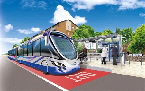
The proposed city budget for the coming year will keep GoDurham service free for all riders for another year.
List of Sidewalk and Street Resurfacing Bond Projects
$60 million to construct approximately 12.4 miles of new sidewalks
The information below is the most current available information from the City of Durham material presented during the budget retreats and available online. We are planning further discussions with staff to get further details and we will update this post as we learn more.
These are projects that have already been in development (design and right-of-way acquisition is complete or nearly so) and will be ready to move to construction in the next 2-3 years (link to staff presentation from April 18). In addition to the sidewalk projects below, the bond referendum would also fund:
$15 million to repair existing sidewalks and ADA curb ramps;
$10 million to pave dirt and gravel streets within City limits
$30 million to fund street paving and maintenance on city streets (We are seeking information from the Public Works department on the city streets that would be included to know more about opportunities to add traffic calming, safer crossings, and bicycle facilities);
Some of the funding for these projects was previously identified in the city’s Capital Improvement Program. This can be confusing, but by funding the completion of these projects with voter-approved bonds, the City frees up additional capacity to add new projects to next year’s Capital Improvement Program.
East Club Boulevard Sidewalks (LC770):
Both sides of East Club Boulevard from Stephenson to Glenbrook (filling gaps/building new sidewalks along ~0.4 miles on each side)
This is a project that the Bragtown Community Association has been advocating for many years.
It will improve access to GoDurham bus routes 9A/9B and connect to the Club Boulevard Housing community.
Hillandale Road Bicycle and Ped (U-4726HN, LCH85):
Both sides of Hillandale Road from I-85 to NC-147 (filling gaps/building/widening sidewalks, building bike paths along ~1 mile on each side)
This stretch of Hillandale Road is an important north-south connection and the site where Seth Vidal was killed while riding his bike in 2013.
It will improve access to a new bus route that is expected to begin operation in August of 2024.
Morreene Road Bicycle and Ped (C-4928, LCM83)
Both sides of Morreene Road from Erwin Road to Neal Road (filling gaps/building/widening sidewalks, building bike paths along ~1.5 miles on each side)
This project will improve access to GoDurham bus route 11B and is an important connection to Duke’s West Campus and Erwin Road from many residential communities, including Morreene Road Housing Community, Damar Court, and American Village.
LaSalle Street Sidewalk (EB-5703, LC187):
Both sides of LaSalle Street from Kangaroo Drive to Hillsborough Road and on west side from Hillsborough Rd. to Sprunt Ave (building new sidewalks along ~0.5 miles on east side and ~0.7 miles on west side)
This project will improve access to GoDurham bus route 11 and Duke bus route LL and is an important connection from the residential communities on LaSalle to Duke and Erwin Road to the south, and the businesses on Hillsborough Road to the north.
Cornwallis Rd Sidewalks/Bike Lanes (U-4724, LCC84):
Both sides of Cornwallis Road from Old Chapel Hill Road to South Roxboro Street (building new sidewalks and bike paths along ~1.2 miles on each side)
This project will close an important gap in east-west access including a connection to Rogers-Herr Middle School.
N. Duke Street Sidewalk (EB-5715, LC189):
East side of N. Duke Street from Murray Avenue to N. Roxboro Road (building new sidewalks along ~1.8 miles)
This project will improve access to GoDurham bus routes 4 and 9A and the residences and businesses along this busy stretch of North Duke Street.
NC 54 Sidewalk (EB-5708, LC190):
South side of NC-54 from NC HWY-55 east to the RTP western limit (building new sidewalks along ~0.4 miles)
This project will iimprove access to GoDurham bus route 12B and GoTriangle bus route 805.
Raynor Street Sidewalks (EB-5704, LC188):
North side of Raynor Street from N. Miami Boulevard to Hardee Street (building new sidewalks along ~0.3 miles)
This project will improve walking access to GoDurham Route 3 and to the second busiest bus stop in the city at Raynor St. and North Miami Blvd.
Five Bike+Walk Corridors 1 (SW-66, LC501):
Five street segments will get sidewalks on this project.
West side of Clayton Road from Chandler Road to Freeman Road; north side of Freeman Road from Clayton Road to Obsidian way (building new sidewalk along ~0.5 miles) (improving access to GoDurham bus route 3B)
Both sides of the Hillsborough Road from 3800 Hillsborough Road (Hilton) to 3414 Hillsborough Road (Sheetz) (filling gaps/building new sidewalks along ~0.7 miles on each side) (improving access to GoDurham bus route 11)
Both sides of Holloway Street from the intersection of N. Guthrie Avenue to N. Miami Boulevard (filling gaps/building new sidewalks along ~0.3 miles on each side) (improving access to GoDurham bus routes 3, 3B, and 3C)
Both sides of Old Oxford Road from 204 Old Oxford Road to 429 Old Oxford Road (filling gaps/building new sidewalks along ~0.4 miles on each side) (improving access to GoDurham bus routes 9A and 9B)
Both sides of W. Corporation Street from N. Duke Street to N. Mangum Street (filling gaps/building new sidewalks along ~0.6 miles on each side) (improving access to GoDurham bus routes 1, 4, and 9A/9B)
Eight Bike+Sidewalk Projects (SW-68, LC504):
Eight street segments will get sidewalks on this project.
West side of Broad Street from the rear side of Walgreens parking lot to Forest Road (building new sidewalk along ~0.1 miles) (improving access to GoDurham Route 1)
Northeast side of the roadway at 3519 Fayetteville Street (Mount Zion Christian Church) (filling sidewalk gap along ~70 feet) (improving access to a bus stop for GoDurham Routes 5 and 7)
East side of Fulton Street from Pratt Street to the Durham Freeway On-Ramp (widening sidewalks along ~0.2 mi) (listed on Durham's Future Pedestrian Facilities GIS site as a mixed-use path)
Both sides of Holt School Road from 3900 Holt School Road to 4102 Holt School Road (filling gaps/building new sidewalks along ~0.1 miles on each side) (improving access to Holt Elementary School)
Both sides of N. Pointe Drive from the intersection of Guess Road to 1915 N Pointe Drive (Red Roof Inn) (filling gaps/building new sidewalks along ~0.3 miles on each side) (improving access to GoDurham Route 1)
West side of the Raynor Street from 611 Raynor Street to 701 Raynor Street (filling gaps/building new sidewalks along ~200 feet on each side) (improving access to GoDurham Routes 3/3B/3C)
Both sides of the SW Durham Drive from 3705 SW Durham Drive to the intersection of Old Chapel Hill Road (filling gaps/building new sidewalks along ~0.5 miles on each side) (improving access to GoTriangle Route 400)
Both sides of Stadium Drive from 801 Stadium Drive to Olympic Avenue (filling gaps/building new sidewalks along ~0.2 miles on each side)
Capital Improvement Program Projects ($16,567,884)
As mentioned above, funding the completion of the above projects with voter-approved bonds, the City frees up additional capacity to add new projects to next year’s Capital Improvement Program.
Durham Downtown Rail Trail, $3,503,126 + $2,400,00 for enhancements
“Beltline” running from North Durham to Durham Station area downtown (~1.8 miles of new bike and pedestrian paths)
Additional amenities including the Gateway Park at the trailhead and lighting and site furnishings along the trail. (Video of the proposed enhancements.)
This would also fund property acquisition at Avondale Avenue to support a future trailhead amenity and parking.
Durham-to-Roxboro Rail Trail, $2,500,000
Planning study for a rail-to-trail conversion of the abandoned rail corridor from near Avondale Drive to Person County border (~18 miles of new bike and pedestrian paths)
The 18-mile corridor would connect the end of the future Durham Rail Trail (Avondale Drive) to the Person County line, passing through the communities of Bragtown, Bahama, and Rougemont along the way.
Mangum-Roxboro Signals for Two-Way Conversion, $500,000
Pavement markings and signal upgrades to convert US 15-501 Business North (Roxboro Street) and US 15-501 Business South (Mangum Street) from a one-way pair system to two-way streets. Design FY 2025, construction beginning FY2026
Guess Road Improvements for Safer Bicycling - NEW, $950,000
Bike and pedestrian facilities on Guess Road between I-85 and Club Boulevard. (~1 mi)
Bike Lane Vertical Protection (LC522), $172,035. This is a request for local funding to replace federal funding so that project can move faster.
Adds vertical protection to buffered bicycle lanes in Durham
New Roundabout Installation - Continuation of LC705, $1,400,000
Roundabout at the intersection of Morreene Road and American Drive to improve safety and slow traffic. (Bike safety improvements around 1 intersection)
This project will be comleted in conjunction with the Morreene Road project that will add sidewalks and bicycle facilities.
School Zone Speed Reductions and Trail Crossing Improvements, $1,210,000
Flashing beacons for Rocky Creek Trail crossing at Elmira St (between Dakota St and Hemlock Ave)
Flashing beacons for S Ellerbee Creek Trail crossing at Stadium Dr (across from Durham County stadium driveway)
School zone flashers for Durham School of the Arts on Stadium Drive
School zone flashers for Central Park School for Children on North Street/Hargrove Street
School zone flashers for Hope Valley Elementary and Durham Academy Middle on University Drive
Pedestrian signals for Club Boulevard Elementary at Roxboro/Lavender
Flashing beacons for Fayetteville St Elementary crossing at Elmira St and Hemlock Ave
Flashing beacons for Morehead Montessori Elementary crossing at Lakewood Ave and Shepherd St
Flashing beacons for Clement Early College High crossing at Fayetteville St and Formosa Ave
Curb radius reduction for Hillandale Elementary at Hillandale/Peppertree
Crosswalk for Brogdon Middle at Leon St and Buchanon
Bump outs for Shephard Middle along Dakota St
Warranted traffic signal on Stadium Dr at new Durham School of the Arts (between Carver St and Shaftsbury St)
Neighborhood Bike Routes 2 and 3 (LC620), $282,723. This is a request for local funding to replace federal funding so that project can move faster.
Englewood Avenue from Georgia Avenue to Watts Street;
Knox Street from Watts Street to Acadia Street
Bivins Street from SR 1127 (Chapel Hill Road) to Arnette Avenue
Iredell Street from US 70 Business (Main Street) to West Club Boulevard
Maryland Avenue from West Club Boulevard to Ellerbee Creek Trail
Cleveland Street/Corporation Street from US 70 business/NC 98 (Holloway Street) to Rigsbee Avenue
Juniper Street from Spruce Street to Guthrie Avenue
Lincoln Street/Grant Street from Lawson Street to Lakeland Street
Ridgeway Avenue/Lakeland Street from Lawson Street to Mathison Street
Lavender Avenue from Elgin Street to Stephenson Street
Stephenson Street from Lavender Avenue to SR 1669 (Club Boulevard)
Umstead street/Lodge Street from SR 1118 (Fayetteville Street) to Fargo Street
Signal Timing Improvements - Continuation of LC259, $300,000
Trail System Repairs, $1,200,000